SZTUTOWO COMMUNE COUNCIL
82-110 Sztutowo, ul. Gdańska 55
tel.: (055) 2478324
Chief of local authority
Commune administrator
EUGENIUSZ WYRZYKOWSKI
Controlling maritime authority
MARITIME OFFICE
IN GDYNIA
ul. Chrzanowskiego 10
81-338 Gdynia
tel.: (058) 6206911, fax: 62206743
Contact of maritime authority
Coast Guard and Fisheries Control
82-110 Sztutowo, ul. Zaułek 1
tel.: (055) 2478374
Harbour radio
VHF Channel 16
Navigational aids:
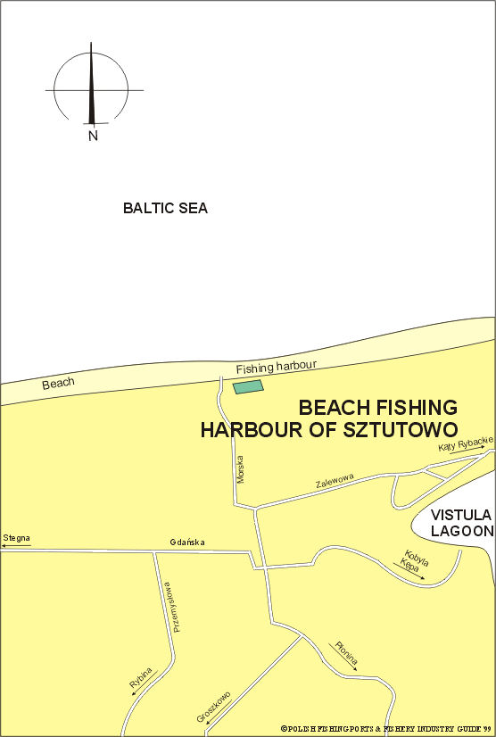
A light (54°22.6'N, 18°57.0'E) is exhibited, at an elevation of 5m,
from a fra-mework tower, 4m in height, on the head of the W mole
of Vistula Adit. Another light is exhibited, an elevation of 6m,
from a framework tower with red and white bands, 5m in height, on
the head of the E mole. Sztutowo lies on the E bank about 2.5 mile E
of the mouth of Vistula Adit.
Quayage and berthing facilities
The fishing harbour is an open beach, where boats are
launched and retrieved with a simple winch.
General facilities
Fuel
Not available.
Water
Available.
Slipping
Beach slipway for fishing boats.
Stevedoring
Not available.
Fisheries facilities
Ice
Not available.
Cold storage capacity
Not available.
Chilling storage capacity
Not available.
Frozen fish transport
Not available.
Types and size of fishing fleet
2 fishing boats (length of 5 to 7m)
and average engine power 25 HP
Types of fish landed (in tonnes) (1995)
GULF OF GDAŃSK:
Flounder
10.2
Herring
3.2
Pike-perch
0.7
Salmon-trout
0.6
Total
14.7
Nearest airport:
Rębiechowo, approx. 50km
General information:
Sztutowo is a fishing village situated about 1.5 miles from the coast
of Gulf of Gdańsk near the mouths of Szarpawa River and Royal Vistula.
Waters of these rivers were famous of sturgeon abundance in the Middle
Ages. The village was built around an inn established in 1432. In
1716 tsar Peter the Great stopped here. In the 17th century a fishing
and farming village developed next to the manor. After 1920 Sztutowo
was a part of the Free City of Gdańsk, with a customs house. Sztutowo
was a site of the Nazi concentration camp Stutthof during the Second
World War with gas chambers and a crematorium. Approximately 85,000
people from 13 different countries perished here, mostly Poles and
Russians. A museum is open on the site.
A mobile life-saving station, equipped with line-throwing apparatus
and radio telephone is based at Sztutowo.